

Hurricane Isaias 2026: Latest Track, Landfall Forecast and Florida Updates
Written By Dilshad AhmadPublished: 09 October 2026 • 11:08 PM IST
Last Updated: 09 October 2026 • 11:09 PM IST
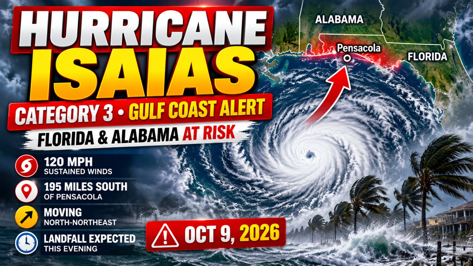
Hurricane Isaias strengthened into a dangerous Category 3 hurricane on Friday, October 9, 2026, as it moved toward the northern Gulf Coast. The Florida Panhandle and coastal Alabama are facing the threat of destructive winds, dangerous storm surge, heavy rainfall and possible tornadoes.
The storm has also attracted significant online attention. A Google Trends screenshot shared on October 9 showed a sharp increase in searches for “Hurricane Isaias,” with the topic marked active. However, Google Trends figures should be interpreted as platform-reported search-interest information rather than independently verified search counts.
According to the National Hurricane Center's 10 a.m. CDT advisory on October 9, Isaias was approximately 195 miles south of Pensacola, Florida, with maximum sustained winds of 120 mph. Forecasters expected the center to reach the western Florida Panhandle coast that evening. Conditions and forecasts can change, so residents should check the latest official advisories before making decisions.
- Update date: October 9, 2026
- Storm category: Category 3 in the National Hurricane Center's 10 a.m. CDT advisory
- Maximum sustained winds: 120 mph
- Expected landfall: Western Florida Panhandle or nearby northern Gulf Coast, according to the forecast available that morning
- Main threats: Life-threatening storm surge, damaging winds, heavy rain, flooding and possible tornadoes
These are time-specific figures, not a live storm position. Consult the National Hurricane Center for the newest advisory.
Where Is Hurricane Isaias Right Now?
In its 10 a.m. CDT advisory on October 9, the National Hurricane Center placed Hurricane Isaias near latitude 27.7° North and longitude 87.3° West. The center was approximately 195 miles south of Pensacola, Florida, and about 145 miles southeast of the mouth of the Mississippi River.
The hurricane was moving north-northeast at approximately 16 mph. Forecasters expected that general movement to continue toward the northern Gulf Coast.
Because hurricanes can change direction and intensity, the storm's position in an earlier advisory may no longer represent its current location. Anyone living near the Gulf Coast should use the latest official forecast cone and local emergency instructions rather than relying on an old map or social media post.
For current storm coordinates, forecast maps, watches and warnings, visit the National Hurricane Center website.
Hurricane Isaias Landfall Forecast
On the morning of October 9, forecasters expected Isaias to approach the northern Gulf Coast during the day and make landfall within the warning area that evening. The western Florida Panhandle and coastal Alabama were among the areas facing serious potential impacts.
The exact landfall location, timing and intensity can change. Even communities outside the storm's center can experience dangerous winds, coastal flooding, heavy rainfall and tornadoes.
Residents should not wait until the hurricane reaches the coast to prepare. If local authorities issue an evacuation order, follow it promptly and use designated evacuation routes.
Which Areas Could Be Affected by Hurricane Isaias?
The northern Gulf Coast is the main area of concern in the forecast available on October 9. Potential impacts vary by location and may extend well inland as the hurricane moves across the Southeast.
| Area | Potential Impacts |
|---|---|
| Florida Panhandle | Hurricane-force winds, dangerous storm surge, coastal flooding and heavy rainfall |
| Coastal Alabama | Damaging winds, coastal flooding, storm surge and possible tornadoes |
| Southern Mississippi | Heavy rain, flooding and potentially damaging winds, depending on the track |
| Southwestern Georgia | Heavy rainfall, flash flooding and possible tornadoes |
| Inland Southeast | Rainfall, localized flooding, strong winds and possible power outages |
Important: This table summarizes potential regional impacts, not a guarantee that every listed location will experience all of them. Check your county's latest alerts and forecasts.
Storm Surge and Flooding Threat
Storm surge is one of the most dangerous hazards associated with a landfalling hurricane. It occurs when hurricane winds push ocean water toward the coast, causing water levels to rise above normal tides. Low-lying coastal areas can flood rapidly, and moving water can be life-threatening.
The National Hurricane Center warned of life-threatening storm surge along parts of the Florida Panhandle and Alabama coast. The storm also had the potential to produce substantial rainfall, creating a separate risk of flash flooding and river flooding.
People should never drive or walk through floodwater. Water may conceal washed-out roads, debris, electrical hazards or unexpectedly deep areas.
How Much Rain Could Hurricane Isaias Bring?
The National Hurricane Center's October 9 advisory forecast widespread rainfall of several inches across parts of the Southeast, with localized totals reaching as much as 15 inches in some areas, particularly across portions of the Florida Panhandle and Big Bend region.
Heavy rain can cause flash flooding in urban areas, low-lying neighborhoods and locations near streams or rivers. Flooding can also occur away from the coast and after the strongest winds have passed.
Residents should monitor local National Weather Service alerts, especially Flash Flood Warnings. If officials tell people to move to higher ground, do so immediately.
Could Hurricane Isaias Cause Tornadoes?
Yes. Tropical cyclones can produce tornadoes, particularly in rainbands outside the storm's center. The National Hurricane Center identified a tornado risk on October 9 across coastal Alabama, the Florida Panhandle and southern Georgia, with the threat potentially continuing into parts of the Southeast on Saturday.
People in affected areas should keep a way to receive emergency alerts and identify a safe shelter before severe weather arrives. A small interior room on the lowest floor of a sturdy building, away from windows, is generally safer during a tornado warning.
What Should Residents Do Before Hurricane Isaias Makes Landfall?
Preparation time may be limited when a major hurricane approaches. Residents should follow local emergency-management instructions and complete essential preparations as early as possible.
- Follow evacuation orders: Leave immediately if local authorities direct your area to evacuate.
- Prepare emergency supplies: Keep drinking water, nonperishable food, necessary medicines, flashlights, batteries and a first-aid kit available.
- Charge devices: Fully charge phones, power banks and other essential devices before power outages begin.
- Secure outdoor items: Bring in loose furniture, decorations, bins and other objects that could become dangerous in high winds.
- Protect important documents: Store identification, insurance information and essential records in waterproof packaging.
- Plan for power outages: Keep flashlights accessible and use generators outdoors, far from doors and windows. Never operate a generator inside a home or garage.
- Stay away from floodwater: Do not drive through flooded streets or walk through moving water.
- Monitor official alerts: Keep a battery-powered radio or another reliable way to receive emergency information.
For official hurricane advisories, visit the National Hurricane Center.
For local weather warnings and flood alerts, visit the National Weather Service.
For evacuation information, shelters and local emergency instructions, check your county or state emergency-management agency.
Why Is Hurricane Isaias Trending on Google?
Google Trends is showing a sharp rise in interest in Hurricane Isaias. The screenshot provided for this article displayed the topic as active and showed a steep upward trend line, alongside related searches such as hurricane tracker, tropical storm watch, flood watch, hurricane Florida and hurricane path.
The surge in interest is consistent with the storm's rapid strengthening and its approach toward a heavily populated and visited part of the U.S. Gulf Coast. People often search for a hurricane's path, landfall time, local warnings, school closures, flight disruptions and evacuation information when a major storm threatens their region.
Google Trends can help identify rising public interest, but it should not be used as a substitute for official weather forecasts. Search activity does not establish the storm's strength, its exact path or whether a specific location is safe.
Will Hurricane Isaias Weaken After Landfall?
Hurricanes typically weaken after moving over land because they lose access to the warm ocean water that fuels them. However, weakening does not mean the danger ends immediately.
Even after the center moves inland, damaging winds, heavy rain, flooding and tornadoes may continue. Rainfall can also cause river flooding after the most intense winds have subsided.
Residents should continue following local warnings until officials confirm that dangerous conditions have passed.
Frequently Asked Questions
Is Hurricane Isaias a Category 3 hurricane?
Yes. The National Hurricane Center classified Isaias as a Category 3 hurricane in its 10 a.m. CDT advisory on October 9, 2026, with maximum sustained winds of 120 mph. Its intensity can change, so check the latest advisory for its current classification.
When is Hurricane Isaias expected to make landfall?
The forecast available on the morning of October 9 called for landfall along the northern Gulf Coast that evening. The exact location and timing can change, so consult the National Hurricane Center for the newest forecast.
Which states are at risk from Hurricane Isaias?
The Florida Panhandle and coastal Alabama were among the main areas of concern. Parts of Mississippi, Georgia and other areas of the Southeast could also experience rain, flooding, wind or tornado impacts depending on the storm's path.
Is storm surge dangerous?
Yes. Storm surge can rapidly flood coastal communities and create life-threatening conditions. Follow evacuation orders and avoid coastal areas where officials have issued warnings.
Where can I track Hurricane Isaias?
The National Hurricane Center provides official advisories, forecast tracks, watches and warnings. The National Weather Service provides local weather alerts.
Does a hurricane warning mean I should evacuate?
A hurricane warning means hurricane conditions are expected in the specified area. Whether you must evacuate depends on local orders and your location. If officials issue an evacuation order for your area, follow it immediately.
Final Update: Stay Alert as Isaias Approaches the Gulf Coast
Hurricane Isaias became a major Category 3 hurricane on October 9, 2026, bringing a serious threat to parts of the northern Gulf Coast. The main concerns include dangerous storm surge, destructive winds, heavy rainfall, flash flooding and possible tornadoes.
Residents should rely on official forecasts and local emergency instructions rather than outdated storm maps or viral social media posts. Because hurricane conditions can change quickly, check the latest National Hurricane Center advisory before travelling or making safety decisions.
Official Sources and Further Updates
- National Hurricane Center — Official Hurricane Track and Advisories
- National Weather Service — Local Weather Warnings
- Ready.gov — Hurricane Preparedness and Safety
- Google Trends — Search Interest